Today, the city of Kyoto stretches outward in every direction in one unbroken sprawl, and it is almost impossible to feel where it ends. But in the Edo period, the word "Kyoto" referred to a much smaller place — a place clearly, physically enclosed by a wall.
The people of that era drew a sharp line between the inside and the outside of this wall. They called the inside Rakuchu (literally "within the wall") and the outside Rakugai (literally "outside the wall"). In modern terms, Rakuchu was the dense, glittering downtown — packed with shops and houses — while Rakugai was the quiet countryside of rice paddies and woods. Kitashirakawa, where Bello Vero stands today, and even the famous Ginkaku-ji, were both firmly on the outside.
This sweeping geography was set in motion in 1591 (Tensho 19), when Toyotomi Hideyoshi — having just unified Japan — decided to remake Kyoto from the ground up. He pulled the war-scattered city back into a single coherent block, and around that block he built one enormous earthen wall. This was the Odoi (the great earthen rampart). The moment Hideyoshi raised that wall, the boundary of Kyoto was fixed.
Even after Hideyoshi's death, the Tokugawa shogunate (from 1603 onward) inherited the wall and used it as the official limit of the city, for census, taxation and policing. Why was such a wall needed in the first place — and how did the people of the Edo period actually see it? Let us trace the surprising history that still sleeps beneath our feet.
CH. 1.11591 — Hideyoshi's Decision: Why a Giant Wall?
In the intercalary first month of 1591 (Tensho 19), Hideyoshi — at the height of his power — abruptly ordered the construction of a colossal earthen rampart, the Odoi, as the capstone of his redesign of Kyoto. Roughly 22.5 km long, it ringed the entire urban core (Rakuchu). The earthwork itself measured about 20 m wide at the base and around 5 m high, with an outer moat 10 to 18 m wide and 3 to 4 m deep. Bamboo was planted along the crest to deter intruders.
Three theories of purpose still stand side by side. (1) A defensive wall against external threat. (2) A flood embankment against the unruly Kamo River. (3) A boundary line separating Rakuchu from Rakugai for purposes of policing and taxation. The accepted view today is that none of these was the single answer — the Odoi was a composite, state-scale project that did all three at once.
What made Hideyoshi's plan so elegant was the way it co-opted natural rivers as its outer moat. The Kamo River formed the eastern flank, and the Kamiya River formed the western flank. By building along these existing watercourses, Hideyoshi shaved enormous time and expense off the project. Districts like Kitashirakawa and Ginkaku-ji — our neighborhood — sat firmly outside this wall, on the Rakugai side. The instant the Odoi was raised, those places were labeled "outside the city," and as a direct result, their farmland and rural character were preserved for the next three hundred years.
Just east of the Kyoto Imperial Palace grounds, fronting Teramachi-dori, stands Rozan-ji, a temple long known as the residence of Murasaki Shikibu, author of The Tale of Genji. Along the eastern edge of its precincts, running beside the cemetery wall, an original section of the Odoi rampart is still in place. This is one of the nine sites designated a National Historic Site as the "Historic Odoi" on July 8, 1930 (Showa 5). Along its eastern flank, the Odoi doubled as the western embankment of the Kamo River — a wall and a flood-control levee in one. It is easy to reach on foot from the city center, and pairs naturally with the temple's Genji Garden, making it the perfect introduction to the Odoi.
CH. 1.2Hyakumanben — The Million Nenbutsu and the Birth of a Student Quarter
If you leave the Odoi behind, cross the Kamo River, and keep walking east along Imadegawa-dori, you arrive at a large intersection where it meets Higashioji-dori. This is Hyakumanben — a place name every Kyoto resident knows. Trace it back, however, and the name opens onto a remarkable story.
The year was 1331 (Genko 1). A great earthquake struck the Kinai region, and an epidemic spread across the capital in its wake. Emperor Go-Daigo issued an imperial command to Zen'a Kuen Shonin, the eighth head priest of Chion-ji, to chant the nenbutsu at court. Together with his disciples, Kuen recited the prayer for seven days and seven nights. When the count reached one million — hyaku-man-ben — the epidemic, it is said, stopped abruptly. To honor the deed, the emperor bestowed on the temple the imperial title "Hyakumanben," along with a great sword-shaped nago calligraphy traditionally attributed to Kobo Daishi and a string of 540 prayer beads. This is the origin of the place name.
Chion-ji itself originated as Kagura-oka, an attendant temple of the Kamo Shrine. After several relocations, it settled at its present location — the northeast corner of Imadegawa and Higashioji — in 1662 (Kanbun 2). In Edo-period terms, this was outside the Odoi, in Rakugai: a quiet stretch of mixed farmland east of the Kamo River and north of Yoshida hill. The honest description is not "a thriving temple town," but "a great temple complex set among rice fields." It was the first temple a traveler heading out of Kyoto along the road to Omi (the Shiga-goe-michi we will visit shortly) would stop to pray at.
The transformation of this district into a "student quarter" began on June 18, 1897 (Meiji 30), when Imperial Ordinance No. 209 founded Kyoto Imperial University. The new university inherited the Yoshida campus from the Third Higher School, and its main gate came to face the southeast corner of Hyakumanben crossing. On July 10, 1933 (Showa 8) the city-tram Higashiyama Line opened between Takano and Hyakumanben, and after the war the area developed into one of the country's most distinctive student districts, packed with secondhand bookshops and coffee houses. On April 15, 1987, the Hyakumanben-san Handicraft Market began on the temple grounds; today, on the 15th of every month, around 350 stalls fill the precincts, and the market is regarded as the originator of all Japan's modern handicraft markets.
Meanwhile, the temple's Great Prayer Bead ceremony still goes on. In the Mieido, monks and visitors form a circle and pass a single enormous rosary — 1,080 beads, roughly 100 m around, weighing about 350 kg — hand to hand in a Buddhist rite held on the 15th of every month (the 25th in August only). The memory of an epidemic from 690 years ago has carried over, in this exact form, into Reiwa-era Kyoto.
The Hyakumanben crossing (Higashioji-dori × Imadegawa-dori). On its northeast corner stands the Mieido of Hyakumanben Chion-ji, rebuilt in 1756 (Horeki 6). A great temple in a sea of rice fields during the Edo period; the threshold of a student quarter from Meiji onward; today, the spiritual home of the city's handicraft markets and used-book fairs. A perfect stop on the way to Bello Vero.
CH. 1.3Shiga-goe-michi — The Diagonal Road Linking Kyoto and Omi
Walk past Hyakumanben and continue a little farther east on Imadegawa-dori, and the city's grid suddenly breaks open: a single road slices diagonally through the residential blocks. This is Shiga-goe-michi, the old highway that linked Kyoto with Omi (modern Shiga). It is also known as Yamanaka-goe, the Shirakawa Highway, and the Biwa Highway.
Its origins are old. Kennaiki, the diary of the Muromachi-period courtier Madenokoji Tokifusa (1414–1455), already records a checkpoint along this route under the older name Imamichi-goe. The 1401 (Oei 8) Hieshrine Muromachi-dono Goshasanki notes that pack-horse drivers (bashaku) clustered along the road, and the route is generally thought to descend from a working road of the Heian era. On the Kyoto side, it began at Kojin-guchi — one of the famed Seven Mouths of Kyoto, at the western foot of Kojin Bridge on Kawaramachi-dori. From there it crossed the Kamo, passed through Yoshida, climbed out of Kitashirakawa over a pass, and reached Shigasato in Omi (modern Otsu). Oda Nobunaga is recorded to have used it routinely on his journeys between Azuchi and the capital.
In the Edo period, the highway gave up its official primacy to the newly improved Tokaido, but it remained, in practice, the shortest line between Kyoto and Omi for ordinary travelers, merchants and freight. The villages along it, especially Kitashirakawa, were famous quarrying grounds for the prized Shirakawa stone — a black-mica granite, used to carve stone lanterns and water basins for tea gardens across Kyoto. According to the 1888 (Meiji 21) village statistics for Kitashirakawa, of 305 households and 1,488 residents, 66 households were stonemasons. By the late Edo period, shops lined the road and the stretch was known as "Kitashirakawa Kyogoku" for its bustle. Shiga-goe-michi was the artery along which Kitashirakawa's stone flowed into the heart of Kyoto.
Modernization tested the road. In 1864, the Owari domain built a new Kyoto residence at Yoshida, swallowing one stretch of the highway into its grounds — the first interruption. In 1889 (Meiji 22) the Third Higher Middle School moved onto the same plot, and the founding of Kyoto Imperial University in 1897 (Meiji 30) inherited the site. Today the highway is completely severed inside the main Kyoto University campus (Yoshida); traces of the old roadbed have been confirmed underground beneath the Main Building, the Faculty of Law and Economics, and the General Research Building No. 7. The "diagonal journey" disappears, in other words, somewhere inside the university.
And it is at this exact spot — the northeast corner of the main campus, near the Kitashirakawa bus stop — that the road resurfaces. From there it ignores the orthogonal grid of Shirakawa-dori (the wider boulevard laid out from late Meiji to early Showa) and slants on through the residential blocks, all the way until it merges with Mikage-dori in Kitashirakawa Shibuse-cho. Zoom in on Google Maps and that "diagonal" jumps straight off the screen. It is a thousand years of human movement, preserved in the shape of the streets above.
A short walk east of Hyakumanben, near the "Kitashirakawa" bus stop on Imadegawa-dori, a roughly 2 m-tall stone Buddha called the Koyasu Kannon stands quietly at the roadside. Believed to be the work of a mid-Kamakura-period sculptor, the figure is mentioned even in the late-Edo guidebook Shui Miyako Meisho Zue as "an extraordinarily large image whose maker is unknown to any age." It is also called Taiko Jizo, the Crying-at-Night Jizo, and the Beheaded Jizo, among other names. Local legend holds that in 1587 (Tensho 15) Toyotomi Hideyoshi had it carried off to the garden of his Jurakudai palace, but the statue rumbled all night long, crying out to be returned to Shirakawa, and was duly brought back.
CH. 1.4Ginkaku-ji-michi — From Rice Fields to a World Heritage Gateway
It may come as a surprise, but the modern Ginkaku-ji-michi crossing (Shirakawa-dori × Imadegawa-dori) did not exist in the Edo period. The reason is simple: Shirakawa-dori, the road that runs north–south through this junction, was itself laid out only between late Meiji and early Showa. In Edo times, the area around the modern crossing was a small farming settlement called Jodoji-mura — only about 59 households and 261 people during the Kan'en era (1748–1751). Ginkaku-ji (formally Jisho-ji) sat quietly in the middle of nothing but rice fields.
Jisho-ji was begun by the shogun Ashikaga Yoshimasa in 1482 (Bunmei 14), on the burnt-out ruins of "Jodo-ji" — the temple destroyed in the Onin War, and the source of the village's name. The popular nickname "Ginkaku-ji" — Silver Pavilion — did not exist in the Muromachi era. It only emerged in the Edo period, as a parallel to "Kinkaku-ji" (Golden Pavilion), Yoshimasa's grandfather Yoshimitsu's villa at Kitayama.
This whole district was reborn as a "gateway" with the completion of the Lake Biwa Canal Branch Line in 1890 (Meiji 23). Water was carried 3.3 km from Keage through Nanzen-ji and Wakaouji to what is now Ginkaku-ji Bridge, with a temple approach extending from the bridgehead up to Jisho-ji — the foundation of the streetscape we recognize today. The narrow service path along the canal became the favorite walking route of two Kyoto Imperial University philosophers, Nishida Kitaro and Tanabe Hajime, and was nicknamed "the Path of Reflection." After a local preservation campaign, it was officially renamed "the Philosopher's Path" in 1972 (Showa 47).
The crossing solidified into a transport node only after the war. In 1954 (Showa 29), the city tram's Shirakawa Line was extended from Higashiyama-Tennocho to "Ginkaku-ji-michi," where its terminus stood. The system was abolished in 1976 (Showa 51). After only twenty-two years as a tram terminus, the crossing has become a major city-bus hub — the entrance through which travelers from all over the world step out toward Ginkaku-ji.
The modern history under our feet here is not 400 years old, nor 300 — just over 130. And in that short window, what was once farmland was reborn as a temple approach by the canal and the new road, became the terminus of a tram line, and finally the gateway to a World Heritage Site. That speed of change is precisely what makes modern Kyoto so endlessly interesting. Next time you wait for the light here, stand a moment longer — you are standing on every one of those layers.
The modern "Ginkaku-ji-michi" bus stop and intersection (Shirakawa-dori × Imadegawa-dori). Rice fields of Jodoji village in the Edo period; a temple approach after the canal arrived in 1890; tram terminus from 1954 to 1976; today, the gateway to a World Heritage Site. A crossing that has changed roles again and again in a brief, dense span of history.
CH. 1.5The Wall Today — The Real Odoi Still Standing at Kitano Tenmangu
Of the 22.5 km Odoi Hideyoshi raised in 1591, the great majority is gone. By the Edo period, its military function had faded; the moats silted up and bamboo groves took over the crests. As the city expanded outward beyond the wall, the rampart became an obstacle to roads and housing, and townspeople gradually levelled it for development.
The decisive blow was Meiji-era urban reform. The land-tax reform and government land-sales after 1872 (Meiji 5) turned long sections of the wall into private property, where they were paved over for housing, roads and railways. The laying of the Sanin Main Line in the late Meiji 20s consumed still more. Today, only nine sites are designated National Historic Sites under the name "Historic Odoi." Of the original 22.5 km, less than 1 km remains visible — under 5% of what was built.
And of those nine sites, the largest and best-preserved by far runs along the western edge of Kitano Tenmangu Shrine, beside the Kamiya River — known today as the Momiji-en Maple Garden, "Historic Odoi." Here the rampart continues for about 350 m north to south, still about 5 m high and about 20 m at the base — almost the original scale, almost untouched. It survived because it had been absorbed into shrine grounds and so escaped the Meiji-era land sales. It was designated a National Historic Site, alongside the eight other Odoi remnants, on July 8, 1930 (Showa 5).
One thing not to miss is the river running just to the west of the rampart: the Kamiya River (the upper reach of the Tenjin River). Hideyoshi folded this natural watercourse directly into his design as the outer moat of the Odoi. The river's name traces back to the Heian-era Kamiya-in, the imperial paper-making workshop that once produced washi here. Nowhere else in modern Kyoto can you stand inside the original combination of rampart, moat and slope all at once. From the ground here, the Odoi is unmistakably not "just an earthen wall," but a single, integrated civil-engineering project designed around the rivers.
The maple garden itself was opened around 2007 (Heisei 19), planted with roughly 350 maples — both green and red varieties — along the rampart's slopes and the Kamiya River valley. At its center stands a magnificent triple-trunked maple, said to be 350 to 400 years old. Each year the garden is opened to the public for green-maple viewing from late April to late June, and for the autumn illuminations from early November to early December. The admission fee includes traditional sweets and tea.
Kitashirakawa, once a "village outside the wall," has long since become one of Kyoto's distinguished residential districts — but the slow, deliberate rhythm it absorbed during its centuries as Rakugai still gives the neighborhood a quiet dignity all its own. Before or after an Italian dinner at Bello Vero, take a walk along the boundary of old Kyoto. You will find that the line Hideyoshi drew in 1591 is still alive, right here under our feet.
Kitano Tenmangu — Momiji-en (Historic Site Odoi Maple Garden) (Bakuro-cho, Kamigyo-ku, on the western side of the shrine grounds). The largest surviving stretch of the Odoi among the nine designated National Historic Sites: about 5 m high, 20 m wide at the base, 350 m long. Hideyoshi's original idea — folding the Kamiya River into the design as an outer moat — is still legible on the ground. You can walk inside the rampart during the green-maple season (late April–late June) and the autumn illuminations (early November–early December).
CH. 1 — TimelineKyoto's Boundary, Handed Down Through the Centuries
| Year | Who | What happened |
|---|---|---|
| 1331 | Zen'a Kuen Shonin | Seven days and seven nights of nenbutsu reach one million recitations and the epidemic ends. The origin of the place name "Hyakumanben." |
| 1482 | Ashikaga Yoshimasa | Begins building Jisho-ji (later "Ginkaku-ji"). At the time, the site lies in Rakugai, in Jodoji village. |
| 1591 | Toyotomi Hideyoshi | Completes the Odoi, the great earthen rampart. The year Rakuchu and Rakugai are formally divided. |
| 1603 | Tokugawa Ieyasu | Founds the Edo shogunate. The wall is inherited as the official boundary of the city. |
| 1662 | Hyakumanben Chion-ji | Relocates to its present site at the northeast corner of Imadegawa and Higashioji. |
| 1872 | Meiji government | Land-tax reform and government land-sales begin. Most of the Odoi passes into private ownership and is destroyed. |
| 1890 | City of Kyoto | Lake Biwa Canal Branch Line completed. Ginkaku-ji Bridge is built; the streetscape of today's temple approach takes shape. |
| 1897 | Meiji government | Kyoto Imperial University founded. Shiga-goe-michi is fully severed beneath the main campus. |
| 1930 | Ministry of Education | The nine surviving "Historic Odoi" sites are designated National Historic Sites. |
| 1972 | Local residents | The philosophers' walking path along the canal is officially renamed "the Philosopher's Path." |
CITY × DINNERAfter the Walk, Stay for an Italian Dinner in Kitashirakawa
Ginkaku-ji-michi, the Philosopher's Path, Shiga-goe-michi — when your legs are tired, we are seven minutes' walk away.
Bello Vero is a small Italian dining room in Kitashirakawa, Kyoto. We are open until 22:00, so an evening walk fits naturally into a relaxed dinner here.
- About 7 minutes on foot from the Ginkaku-ji-michi bus stop
- Open through 13:00–22:00 (closed Mondays plus occasional days off)
- Counter seating available; solo diners welcome
- Vegetarian and gluten-free options on request
CH. 1 — SourcesReferences
- Kyoto City Cultural Properties Protection Division, "Odoi"
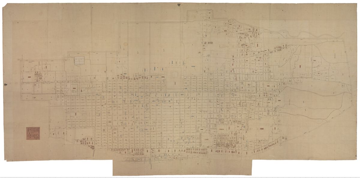
- Kyoto University Rare Materials Digital Archive, Kanei-go Manji-zen Rakuchu-ezu (early-Edo Kyoto street map) and Miyako Meisho Zue (illustrated guide to famous places of the capital)
- Madenokoji Tokifusa, Kennaiki (court diary, 1414–1455)
- Akisato Rito, Miyako Meisho Zue and Shui Miyako Meisho Zue (illustrated guides to famous places of the capital)
- Kitano Tenmangu Shrine, official website and Momiji-en (Historic Site Odoi Maple Garden) materials
- Hyakumanben Chion-ji, official website
- Tetsugaku-no-Michi Hosho-kai (Philosopher's Path Preservation Society)
- Kyoto University Press Society, "Walking the Shiga-goe-michi"
- Kyoto City Historical Materials Hall, ed., Kyoto no Rekishi (History of Kyoto), all volumes